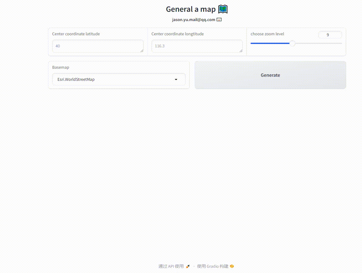
DEMO 5-1: Interactive Map Generation Using Gradio and Leafmap
import gradio as grimport leafmap.foliumap as leafmap# Define a function to generate a map based on provided parametersdef generate_map(zoom_level, maptype="Esri.WorldStreetMap",coordsy='', coordsx=''):if coordsy ==''and coordsx =='': coordsy =40 coordsx =116.3print(maptype)# Create a map object centered at the given coordinates with the specified zoom levelmap= leafmap.Map(location=(coordsy, coordsx), zoom=zoom_level)map.add_basemap(maptype)returnmap.to_gradio() # Return the map in html formatwith gr.Blocks() as demo: gr.HTML(""" <center> <h1> General a map 🗺️ </h1> <b> jason.yu.mail@qq.com 📧<b> </center> """) with gr.Row():with gr.Row(): coordinates_input_y = gr.Textbox(value='',placeholder=40,label="Center coordinate latitude",lines=1) coordinates_input_x = gr.Textbox(value='',placeholder=116.3,label="Center coordinate longtitude",lines=1) zoom_level_input = gr.Slider(value=9,minimum=4,maximum=15,step=1,label="choose zoom level",interactive=True)with gr.Row(): maptype=gr.Dropdown( choices=["Esri.NatGeoWorldMap","Esri.WorldGrayCanvas","Esri.WorldImagery","Esri.WorldShadedRelief","Esri.WorldStreetMap","Esri.WorldTerrain","Esri.WorldTopoMap", ],value="Esri.WorldStreetMap",interactive=True,label="Basemap") map_button = gr.Button("Generate",scale=1)with gr.Row(): map_output = gr.HTML() # Define the output as an HTML object map_button.click(generate_map, inputs=[zoom_level_input,maptype,coordinates_input_y,coordinates_input_x], outputs=[map_output])demo.queue().launch() # Start multi-thread processing mode